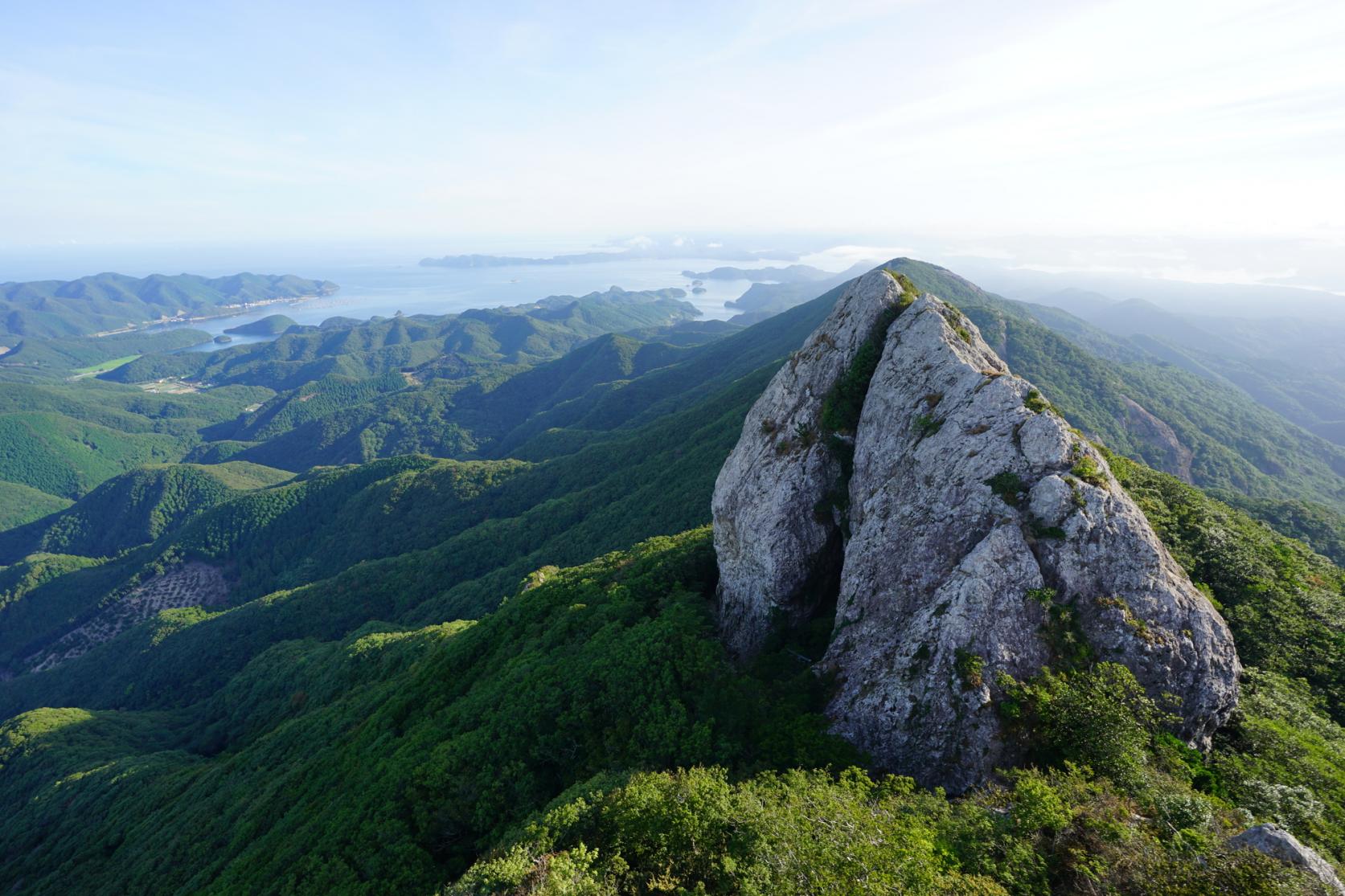
Mountain Madness
As the weather gets cooler, get your blood pumping with a hike up one of Nagasaki Prefecture's abundant mountains. Autumn leaves, or koyo, make for some spectacular views among the trees. Be sure to wear sturdy shoes and pack appropriate gear as the temperature atop some of the higher peaks can drop suddenly. Always let someone know where you're going before you head out and immerse yourself in nature!
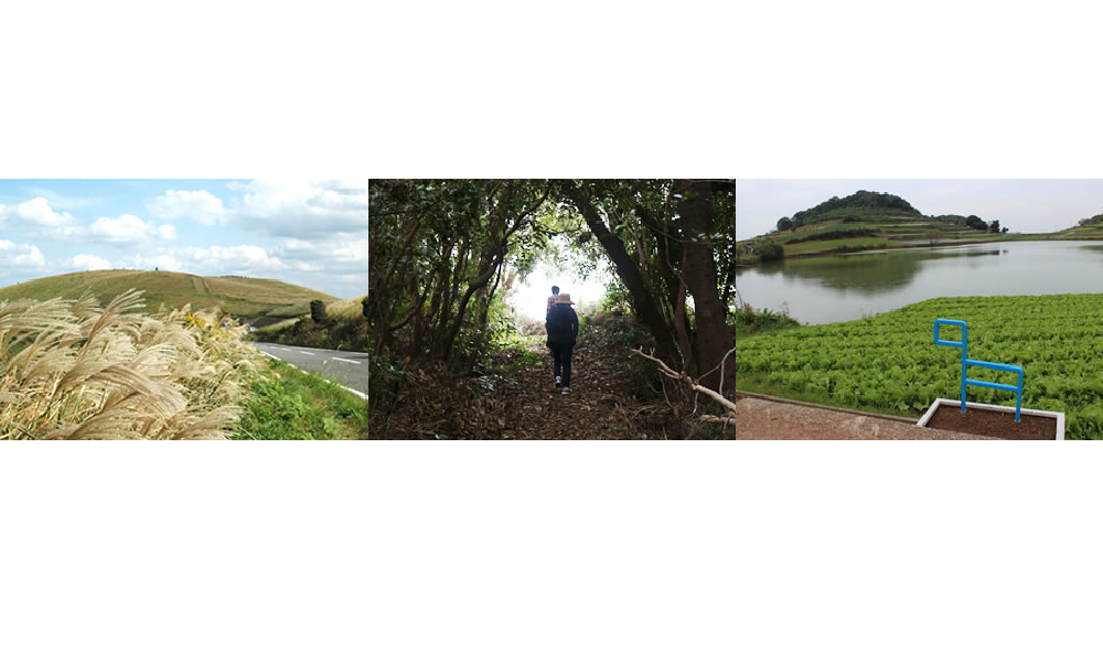
Fugendake & Heisei Shinzan Volcano
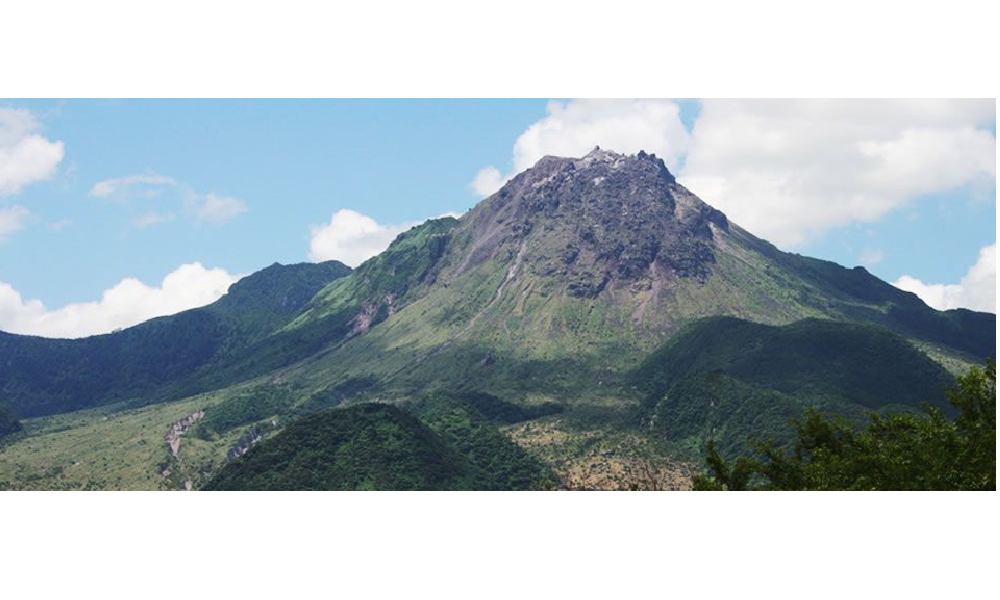
Rising above the quaint town of Unzen, the grandeur of Mt Fugendake and Heisei Shinzan are lovely to behold. The name Heisei Shinzan is derived from a combination of the name of the previous Japanese era, Heisei (1989-2019), the word shin, meaning 'new', and zan, meaning 'mountain.' As the name suggests, it is Japan's most recently formed mountain, emerging from the 1990-1995 chain of eruptions of Mt Unzen.
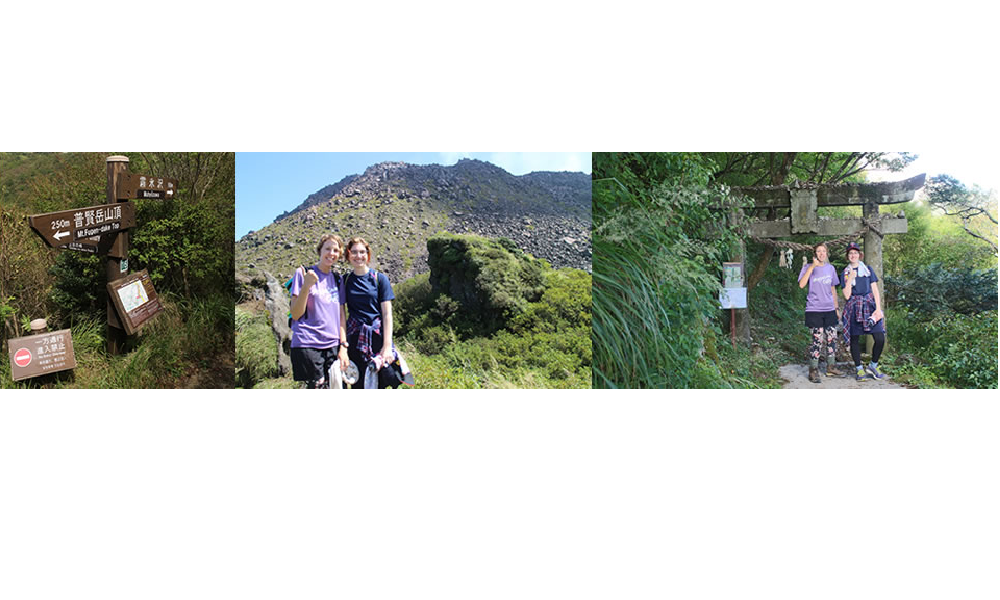
There are several hiking routes along the ranges, but the most popular is Mt Fugendake (1359m). It is the highest hikeable peak, and only several hundred meters away from Heisei Shinzan (1486m). A short 15 minute drive from the town center will take you through the Unzen Volcanic Area to Nita Pass. Just past the first sightseeing platform, a large car park marks where you can catch the Nita Pass Ropeway, the cable car that transports visitors over the deep valley below.
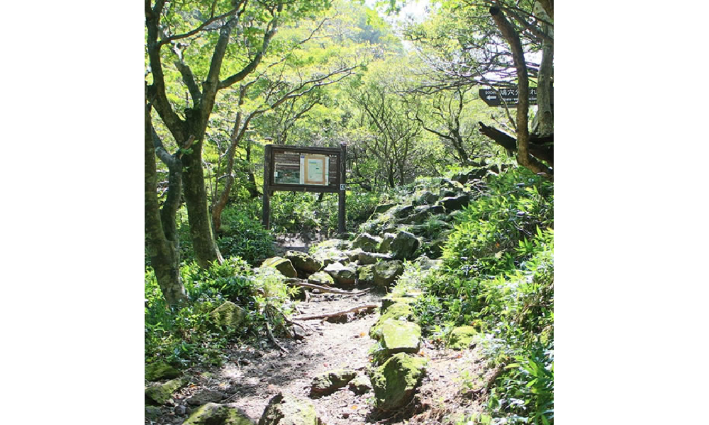
Skipping the ropeway and walking through the valley adds around 30-40 minutes of rocky up and down trekking to your hike, so we recommend riding the ropeway and beginning your hike from Myoken Station on the other side. Take in the first of many breathtaking views of the valley below, then enter the trail via a small concrete torii gate at Myokendake temple. After that, continue along the ridge. The one-way loop past Hatoana-wakare junction takes you by two lava caves and hundreds of naturally formed stone columns. For intermediate hikers, the entire course takes approximately 4 hours from Myoken Station at the top of the ropeway.
If you have limited time in the area, the shorter 2 hour course skips Heisei Shinzan and follows the traditional route through the range. Take the signs toward Momiji-jaya and Fugendake. Although the hiking distance is halved, this is still a great way to see the gorgeous view over the city of Shimabara from the summit of Mt Fugendake. Relax and gaze across at the newly formed mountain as it puffs white smoke into the clear sky above. If the weather is kind, you may even be able to enjoy views over the Ariake Sea and out toward Kumamoto Prefecture.
After the hike, soak away your fatigue and unwind at one of the many onsen (hot springs) located around Unzen City. Unzen is also known for its hashed beef (hayashi rice), a dish purportedly introduced to the area by Western tourists several decades ago after the opening of Japan's first resort for Westerners there. Unlike traditional hashed beef, Unzen's version adds potatoes, grown locally in volcanic soil. The warmth of the potatoes, combined with the thick gravy, goes down especially well after a day in the mountain air. Pay a visit to the Unzen Tourism Association building for information on sightseeing spots and a map of all the restaurants in the area. Oyama Information Center also has informative maps of the ranges to take with you on your mountainous adventure.
Written in partnership with the Nagazasshi.
Words by Jessica Richard.
Minami-Shimabara Olle
Inspired by the 'Jeju Olle' hikes, popular on the island of Jeju in South Korea, the Kyushu Tourism Promotion Organization has started its own 'Kyushu Olle' hiking series. Hiking trails are scattered all over Kyushu, traversing everything from neighborhoods to forest trails. Officially recognized by Jeju's Olle Foundation's strict criteria, all trails are easy to navigate as they are marked with ribbons and arrows, and accompanied by Ganse ponies, the symbol of Jeju. Courses are characterized by an abundance of beautiful nature, mild terrains, and mostly unpaved roads.
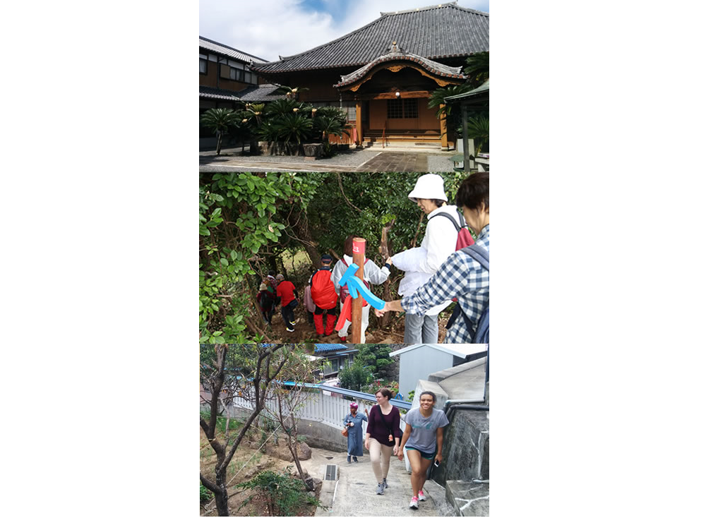
One of the Kyushu Olle Trails is located in Minami-Shimabara. The trail perfectly encapsulates the Jeju definition of 'Olle'. The 10 kilometer course begins at the Kuchinotsu Ferry Port, where there are bamboo walking sticks free for hikers to borrow.
At first, the path winds through traditional Japanese residential areas and takes walkers past a local shrine. As you follow the incline, you will find yourself walking along the narrow paths of agricultural fields. Though it may seem intrusive to trek alongside the local farmers planting their crops, it is great to feel so close to nature. Follow the blue and red trail markers and continue up and up until you reach a clearing. There, stop to catch your breath and enjoy the first breathtaking panoramic view of the Ariake Sea.
The scenery quickly changes to forest during the descent. Here's where the bamboo sticks come in handy! Once at the bottom of the hill, you will find yourself on paved road, just meters away from the sea. Small paths leading towards the water allow the option to step off the road and walk along the rocks. Continue along the seaside trail until it ends at the Kuchinotsu Museum of History and Folklore and there you have it!
From suburbs to fields and forests to oceans, this trail allows walkers to truly experience everything the southern Shimabara peninsula countryside has to offer. The trail is clearly marked, with ribbon markers at times located in the most obscure places, giving the hike an almost scavenger hunt feel. As a bonus, the ocean-side road has informative signs on the geologic features, both in English and Japanese. The path also passes through several parks, including one with a zip line and roller slide. There is truly something for everyone on the Minamishimabara Olle walk!
Written in partnership with the Nagazasshi.
Words by Irene Klock.
Mt. Shimizu
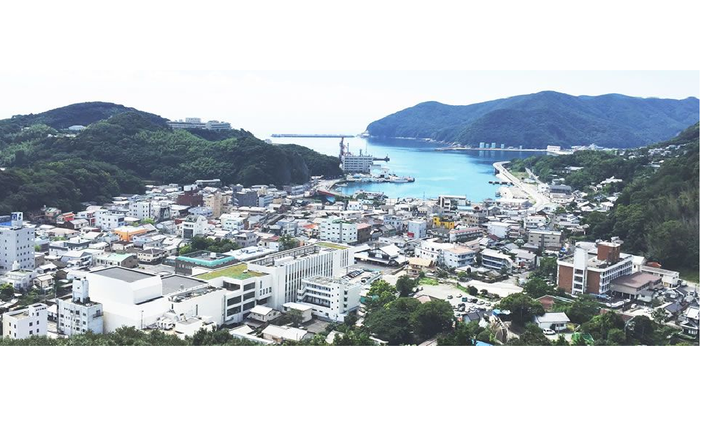
Explore Tsushima's rich history while enjoying stunning port town views from the summit of Mt Shimizu. A short walk from Tsushima's largest town, Izuhara, Mt Shimizu is the site of the ruins of Shimizuyama Castle.
The castle was built in 1591 during the Imjin War by noted daimyo (feudal lord) Toyotomi Hideyoshi. Located directly between Japan and Korea, Shimizuyama Castle's location on Tsushima played an important strategic military role- acting as a point for troops to gather before continuing on to Korea. Today, all that remains of Shimizuyama Castle are the ruins of three castle walls. Built from large stones slotted and piled together, the walls are over 2 meters high in some places.
Start your journey by browsing the exhibits at the Tsushima History & Folk Customs Museum, and then get ready to head out into nature! Follow the signs for Shimizu Castle Ruins until you see the first set of castle walls, Sannomaru (三の丸). Only a short climb away, this first landmark provides the first of many breathtaking views of the Izuhara port. On a clear day, gaze out toward the horizon and see if you can spot the neighboring island of Iki, almost 50km away.
Continue along the path to the second fortification, Ninomaru (二の丸) and a stunning second lookout. Follow the path along the ridge as it gently climbs 100m to the summit and to the final set of walls, Ichinomaru (一の丸). There, you will be greeted with magnificent views of the sea and town below.
Mt Shimizu is a beginner level hike that can easily be completed in an hour. However, the intermediate level ascent to Mt Ariake can also be made from the same starting point (4-5 hour round-trip).
Written in partnership with the Nagazasshi.
Words by Dominic Balasuriya.
Mt. Nabekanmuri
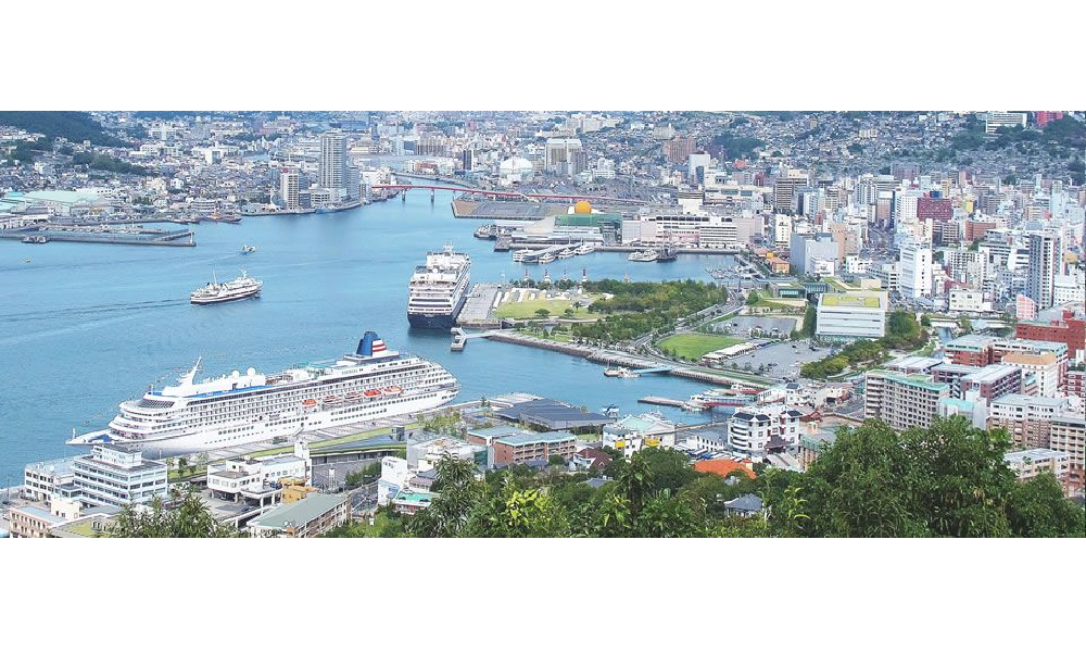
Beyond the busy docks and bustling streets of Nagasaki, Mt Nabekanmuri watches silently over the city. Often overshadowed by its sister, Mt Inasa which boasts one of the top three night views in the world (World Night View Summit 2012), Mt Nabekanmuri offers an arguably more magical view of the city, especially at sunrise and sunset.
The journey up the mountain takes approximately 30-45 minutes and provides a refreshing respite from the hustle and bustle of city tourist spots. Catch the No. 5 streetcar to Ishibashi Station and follow the signs towards the Glover Skyroad. From here you may opt to take the stairs, but the free Skyroad elevator is great for those with weak knees!
Once you reach the top of the Skyroad, an elevator takes you further up the slope, coming to an end at the back entrance of World Heritage listed Glover Garden. The view from here takes in many nearby tourist attractions such as the Oura Cathedral, the Confucian Shrine, Western-style Houses at Higashi-yamate and the Old Photograph Museum.
Walk past Glover Garden and follow the signs that point toward Mt Nabekanburi on the left. The Shotokuin Buddhist Temple marks the halfway point of this walk. Maintained by the local residents, the surrounding path and temple is usually neatly manicured. Be sure to enter the temple grounds to see an impressive northeastern view of the city through its torii gates. The trail then continues up several more flights of stairs, concluding at the elevated viewing platform.
Before you know it, Nagasaki city is spread out far below you. If you time your walk just right, the sky becomes a beautiful palette of colors and glittering lights appear as the sun sets over the Venus Bridge and Mt Inasa in the west.
If you don't fancy a hike, road access will take you as far as Mt Nabekanmuri Park. From there, it is only a short walk to the viewing platform. With these spectacular views and such easy access from Nagasaki city, there is no reason not to come and take on Mt Nabekanmuri!
Written in partnership with the Nagazasshi.
Words by Naomi Louise Jenkins.
----------------------------------------------------------------------------------------------------------------------------------------------------------
Collaboration Pages: Nov-Dec 2016 issue
The Nagazasshi is Nagasaki's No. 1 English language magazine. You can read it online at www.nagazasshi.com
The Nagazasshi is also on Facebook! http://www.facebook.com/nagazasshi
Like the page to keep up to date with all the best news and views from the international community in Nagasaki.